Geolocation of photos
Just before I went on my summer holiday I decided that it was time to buy myself a "proper" digital camera to replace my much loved 35mm Olympus XA. The rest of my family all have their own digital cameras and I was aware of the high utility of digital cameras but I'd managed to persuade myself, until recently, that I should wait a bit longer. What finally pushed me over the edge was not just that it seemed that digital cameras were now "good enough" but also that I wanted to try out geotagging photos.
First step was to choose a camera. The choice of digital cameras is huge, and even after apply severe budgetary constraints and choosing the size I wanted (not too big "the best pictures get taken by a camera you have with you, not one left at home", and not too small), I ended up in a state of paralysis, unable to choose between two models of Canon A-series cameras. Eventually I went for the A620 on the basis that it was cheaper (by about £50) and that the chance of choosing a camera that I wouldn't want to improve on as I learned more about digital photography was about nil.
The next step was to carry my trusty Garmin Vista C with me at all times when I was taking photographs on holiday. This was easy enough, and I always make sure I "saved" my tracks in the GPS and I regularly copied the tracks over to my laptop. I even remembered to synchronise the clocks on the two devices.
Back home, I was faced with working out how to combine the gps tracks with the photos. I thought there ought to be some easily available software to address the task. The first thing I came across was WWMX,a now-dead Microsoft Research project, for which the (PC) software is still available for download. WWMX "location stamper" seemed to be what was needed. You fire up the application; select some photos you want to geotag; select some gps tracks; click a button, and off it goes, working out the location where the photo was taken and updating the Exif information accordingly. Except that it didn't work with the first photos and traces I chose. The problem turned out to be that the Vista removes the timestamp information when it "saves" the track (I suppose this is not so unreasonable if all you are doing is navigating). Fortunately, I had been copying from the Vista to the laptop regularly. I had the unsaved, and hence timestamped, tracks for most of my journeys. I successfully geotagged a few photos as a test.
Great. What next? I wanted to my photos on a map. In the course of searching for the geotagging software, I'd seen that Flikr now supported geotagging and mapping, so I thought I'd try it out. To cut a long story short, once you discover the well-hidden switch which tells Flickr to take notice of geotagging information in uploaded photos, all worked OK. I can now click on a "map" link next to my geotagged photos and see a map with my photo on it. The only remaining problem is that the Yahoo mapping used by Flickr is pretty poor. I'll have see how to get something to work with Google maps.
So, to finish, a picture of where I went on my summer holiday.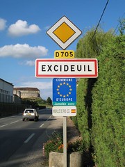
Final admission. The A620 is actually the second digital camera I have bought myself. The first was a BarbieCam.


1 comment:
Hello, I came across your blog as i was searching for information about automatically geotagging photos. I've been doing it for sometime, but recently acquired a gps so hoping I can do it automatically now.
I've been using Tripprmap to create an interactive photo map (http://www.flickrmap.com) for a while, before flickr had even done their maps stuff and even now prefer that to the flickr maps, might be worth a look for you?
Post a Comment